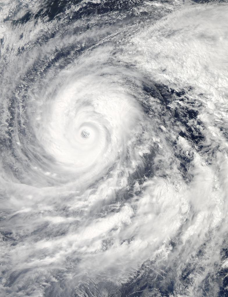
Source updated ※August 16, 2024 18:55 NHK The extremely strong Typhoon No. 7 is moving northward with a storm area and is closest to the Kanto region. After this, the rain and wind will suddenly become stronger, causing severe winds that can fly off signs and overturn trucks while traveling. In addition, linear precipitation bands are expected to occur in the Kanto region, Fukushima Prefecture, and Miyagi Prefecture, rapidly increasing the risk of flooding and landslides. Even if the typhoon does not make landfall, please refrain from unnecessary outings and stay in a safe place. According to the Japan Meteorological Agency, as of 7 p.m. on the 16th, the extremely powerful typhoon No. 7 was moving north-northeast at a speed of 15 kilometers per hour over the ocean 150 kilometers south-southeast of Choshi City, Chiba Prefecture. The central pressure is 950 hectopascals, the maximum wind speed near the center is 45 meters, and the maximum instantaneous wind speed is 60 meters.Within 165 km to the southeast and within 95 km to the northwest of the center, strong winds of over 25 meters are blowing. The typhoon is closest to the Kanto region at this time, so be on high alert. Winds are getting stronger in the Kanto-Koshin region, with the maximum instantaneous wind speeds observed in the three hours up to 6pm reaching 25.2 meters in Tsubota, Miyakejima, 23.7 meters in Choshi, Chiba, and 20 meters in Tateyama, Chiba. In addition, due to the inflow of warm and humid air from around the typhoon, locally developed rain clouds are flowing into the Kanto region. In the hour leading up to 6pm, 24mm of heavy rain fell in Yokoshibahikari Town, Chiba Prefecture. The typhoon is expected to continue moving northward and come closest to the Pacific coast of Tohoku between the early hours of the 17th and dawn. Very strong winds are expected to blow over a wide area of the Kanto region, with localized severe winds possible even on land. The maximum wind speed on the 16th is expected to be ▽40 meters at sea in Kanto ▽30 meters on land in Kanto and at sea on the Pacific side of Tohoku ▽25 meters in the Izu Islands ▽20 meters on land on the Pacific side of Tohoku, and the maximum instantaneous wind speed is ▽60 meters at sea in Kanto ▽45 meters on land in Kanto and at sea on the Pacific side of Tohoku ▽35 meters on land on the Izu Islands and the Pacific side of Tohoku. Heavy rain expected in Kanto area Linear rain bands also expected Continue reading↓ [Latest information on Typhoon No. 7] Closest approach to Kanto, extremely strong force moving north with storm area, what is the course? What are the effects? Please refrain from unnecessary outings | NHK | Typhoon ※Previous thread [Latest information on Typhoon No. 7] Expected to be closest to Kanto late tonight★2 [Gure★].
>>1 The wind on the left side of the direction of travel is offset by the speed of travel, so there is not much wind. I wish the weather forecaster had said something as basic as that.
Because of excessive hype on television, transportation services have been suspended, hotels, inns, and tourism have been affected, and the economic impact has been severe.
I live in Yamanashi Prefecture, which has been in the national news due to the fear of a linear rain band. The rain comes in sporadic bursts but then stops again quickly. The wind is nothing more than a gentle breeze. Currently, there is still no wind.
It’s been predicted for a long time that it wouldn’t make landfall, so why did they hype it up so much? Was the Shinkansen really something to be worried about?
Even though they know that the course changed in the afternoon and that there wasn’t much happening in Tokyo, these corrupt media outlets continue to exaggerate the situation and make it into a story.


Comments